The Mystery of Malaysia 370
April 4, 2014
“Good night Malaysian three seven zero” were the last known words spoken by MH370’s crew to Malaysian air traffic control, nearly forty minutes after the Malaysia Airlines flight departed Kuala Lumpur International at 12:41 a.m. local time on March 8.
A red-eye, routine flight from Kuala Lumpur to Beijing vanished from international radar tracking systems in one of the most baffling enigmas in aviation history.
Malaysia Airlines says it first lost contact with the Boeing 777-200ER, with 239 aboard, at 1:30 a.m. local time, five hours before its scheduled arrival in Beijing. Air traffic control in Subang Jaya, Malaysia lost contact with the aircraft an hour and ten minutes later.
A global search endeavor has ensued. Six countries are currently collaborating on an effort to locate the wreckage of the wide-body Boeing, with the Malaysian authorities pioneering the operation. Assisting the initiative is the Chinese Civil Aviation Administration (CAA) and London-based telecommunications company Inmarsat.
Data analysis by Inmarsat using the Doppler effect of radar showed that the flight almost certainly plunged into a remote area of the Indian Ocean, approximately 1200 miles off the coast of Perth.
“Malaysia Airlines deeply regrets that we have to assume that MH370 ended in the southern Indian Ocean. As you will hear in the next hour from Malaysia’s Prime Minister, new analysis of satellite data suggests the plane went down in the Southern Indian Ocean,” the airline said in a press release on March 24.
Long-range aircraft such as the 777 carry many systems aboard which transmit technical data from the plane to the ground. However, none transmit location, which is instead tracked externally by ground control radar. Both the Aircraft Communications Addressing and Reporting System (ACARS) and the plane’s transponder ceased transmission of such data between 1:07 a.m. and 1:37 a.m. in a small gap between Malaysian and Vietnamese airspace.
Global speculation has run wild. Some argue these systems were deactivated in order to divert the aircraft, while other theories speculate that equipment was damaged in an electrical fire; still others conjecture that the electrical systems were intentionally switched off to hinder such a fire.
Captain Harlan Davis, a Senior Pilot for United Airlines, shared his insights with The Winged Post regarding his theory on what happened to Flight 370. Davis has flown almost all Boeing aircraft including the 777 for almost 40 years, including routes in the East in the same airspace where the fated Malaysia Airlines jet disappeared. Check out the interview below.
“[The pilots] went up to 45,000 feet, which would pretty quickly deprive all the passengers of oxygen, and make them all pass out, so they could do what they wanted without any interference,” said history teacher and ex-Navy Captain Carol Zink. “They clearly didn’t correctly calculate their distance-to-fuel ratio, because they didn’t make it to wherever they intended to go.”
Mathematics teacher Anthony Silk has a degree in Aerospace Engineering. Silk has a similar theory about how the flight has been hijacked.
“The transponder was turned off, which is a very unusual circumstance. If somebody was trying to divert the plane, that is the first thing they would do,” he said. “I’m only guessing from what I’ve seen in the papers, that the plane was diverted, started flying out towards the Indian Ocean, and then […] they ran out of gas.”
Nikhil Parmar (10) has a different opinion. Nikhil presumes the disappearance was merely an aircraft-related mechanical failure.
“Probably an engine just failed, and the plane went down somewhere in the Indian Ocean,” he said, “It seems most probable considering that we can’t find the plane; it doesn’t seem very likely that it would’ve been hijacked, especially after 9/11.”
Less than a week remains before the plane’s ‘black box’ will run out of battery power and cease transmission of pings signaling its location, rendering it far more difficult to locate. However, the data on the chips will remain intact for years.
The device contains aircraft telemetry data and an audio recording of the cockpit for the last two hours of a flight. The search for the wreckage of the aircraft and the black box currently encapsulates a wide area between 1200 to 1500 miles off the west coast of Australia.
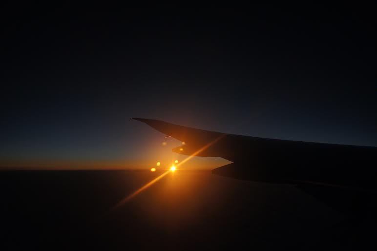
Featured photo: Shay Lari-Hosain
This piece was originally published in the pages of the Winged Post on April 4, 2014.
Q&A: A Veteran Pilot’s Take on the Mystery of MH370
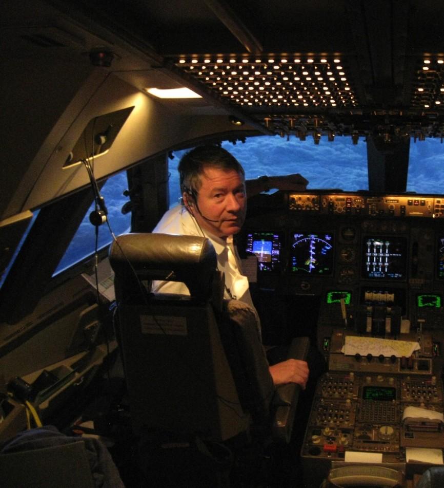
Image Courtesy of Capt. Harlan Davis
Capt. Harlan Davis is currently a Senior Pilot for United Airlines. He has flown almost all Boeing aircraft including the 777 for almost 40 years, including many routes in the East in the same airspace where Flight MH370 disappeared.
Shay Lari-Hosain What is your theory on what happened to the Malaysia Airlines flight?
Harlan Davis We know for sure that the airplane was carrying a significant amount of lithium ion batteries. Here’s my best guess, and theory is being generous; it’s more of an educated guess than anything else. Something catastrophic happened; could it be these batteries on board that were improperly packed? Yeah. I’ve flown the 777 for about a year; the E&E compartment as it’s known is located below the flight deck, and it’s where all the actual equipment is located. If [a] fire worked its way forward from the cargo compartment, it could have very quickly done serious damage cutting off power supply to the transponder.
Now, when you get a fire on an airplane, you pretty much [have] about anywhere between 15 but no more than 30 minutes to get it on the ground or get it in the water, or you’re a goner. Fires on airplanes are a horrible, horrible thing. There are too many items, insulation, seat covers, plastic bulkheads that burn violently and quickly. The fumes from this stuff are almost always toxic, and if the oxygen system wasn’t working right, there’s no way anybody could survive that.
I’ve flown through that same airspace in a 747 numerous times. There is a piece of that airspace which is not under radar coverage; it’s just too far out in the ocean. Now, it’s likely that some radars were picking them up, but who and what and to what extend that information will be made public is anybody’s guess. If some spy agency had radar coverage on them, the last thing they’d want to do is admit it.
It looks like they did what we call a ‘high dive,’ a rapid descent from altitude to get down to 12,000 feet, so that they could depressurize the cabin completely and blow the cabin out. If there was a lot of smoke in the cabin they may have done just that, set the autopilot on a heading basis or set it to go directly to a particular waypoint or airport. If [the pilots] were overcome by the smoke, once the autopilot reaches that point, it maintains its altitude and heading. And that altitude and heading would’ve taken [the plane] out into the south Indian Ocean.
[They] would’ve put maybe eight hours of fuel on the airplane for their six hour flight. Given that airplane was last radar tracked at 12,000 feet, [the aircraft was] burning about double the fuel per unit of distance than they would have at altitude [35,000 feet]. That would have given them a range of about 1500 miles.
The new search area mysteriously was chosen [on March 28], and that’s where the airplane would have flown before it ran out of fuel. This whole business of shifting the search area for Malaysia 370 is probably the result of some super secret spy agency quietly leaking information to somebody who promised to hold the secret.
The problem with that part of the Indian Ocean, is not only is it deep, but the terrain down below is extremely mountainous. The currents around Antarctica and especially that part of the southern Indian Ocean are so incredibly remote; they are thousands of miles away from any speck of land.
SL So what different types of equipment are on board an aircraft for conveying location data?
HD [On most flights such as Malaysia 370], there’s nothing at all on an airplane that sends out where it was. The only way you knew where an airplane was, was by receiving the transponder reply, which is a series of four sets of three bits. Transponders send back a code which [a] computer immediately [identifies], plots on the screen, and keeps up with the location of the response in real-time. Pinged multiple times, you’ll get real-time altitude and real-time identification readouts. And that’s how radar has been for the last fifty years.
The media refers to the flight data recorder and cockpit voice recorder as ‘black boxes.’ They’re not; they’re orange and they sit back in the rear end of the fuselage. They have a battery on them that sends out a radio signal for about 30 days; and we are coming up real close to that 30 day mark, with about a week left [to find it]. If [the search teams] don’t get within a mile of the wreckage, they will never hear those pings.
SL So I know a lot of people are asking, how is it possible that not a single passenger on the Malaysia Airlines flight ever used their cellphone to make a call?
HD Cellphone antennas are ground-wave only; if you’ve got a cellphone on, the ability for a cellphone above about 2500 feet to pick up a ground-based signal is pretty much nil. They simply are incapable of doing it. For some reason, most people think you can use a cellphone at 35,000 feet. That far out at sea, even if you were down at the appropriate altitude, you’d never pick up a cellphone signal. And that’s something a lot of people don’t understand. When these pilots made this abrupt, almost U-turn, they were a hundred miles from any landmass, so there was no way any consumer equipment could possibly have connected to anything on the ground.